World’s Aerial Photographs, You have Never Seen it Before
Tauheed Ahmad Nawaz
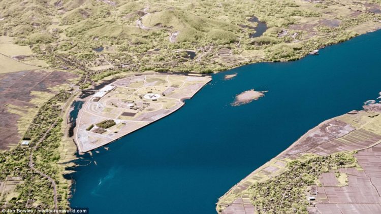
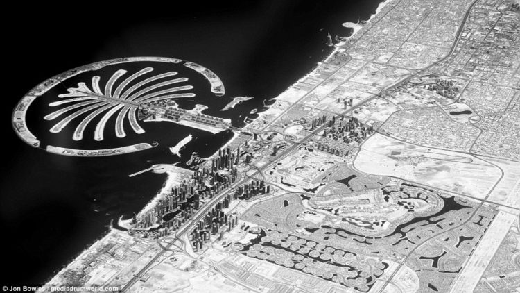
Planet earth is extremely beautiful, and by seeing these Aerial photographs, you’d take a long breath and feel like you’ve never seen it before. A British pilot exposes, winding rivers, glittering skylines, and tall peaks under infrared light. The earth is best viewed from above, by taking incredible aerial photographs of majestic landscapes. The British pilot Captain Jon Bowles takes Dubai’s man-made Palm islands from his cockpit at altitudes of up to 40,000ft.
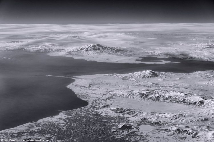
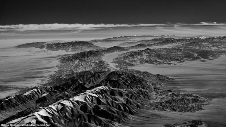
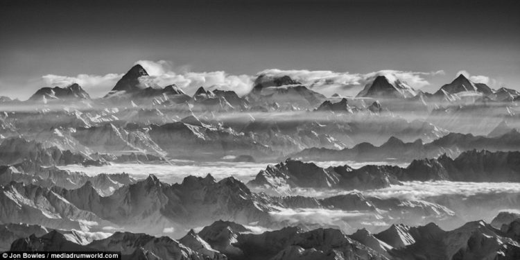
He has taken some incredible photos of K2 peaks, the 2nd highest mountain in the world in the Himalayas, Mount Kilimanjaro, Canada’s frozen Labrador coast, the Great Rift Valley in Africa, the Kunlun Mountains in China, Iran’s Lake Urmia, Lake Van the largest lake in Turkey, Padma River in Bangladesh, and the sacred waters of the Ganges Delta and Kunyang Chhish mountain & salt flats of Pakistan.
The Bolton-based, 55 years old pilot, used a modified Sony Nex 5N camera to capture these breathtaking pictures in a completely different spectrum. His astonishing shooting shows the world in a light impossible for the human eye to detect.
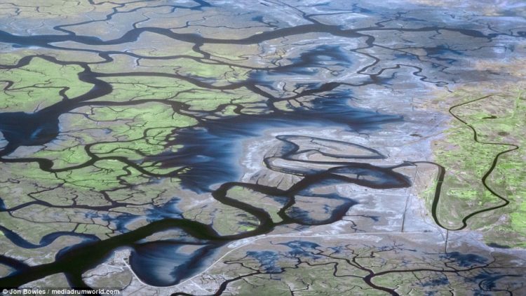
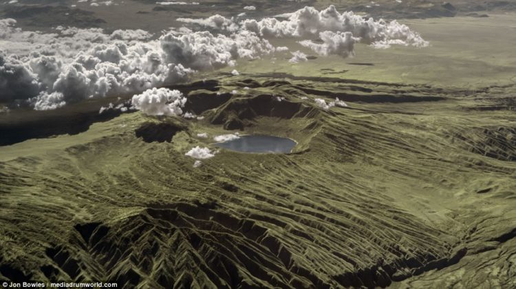
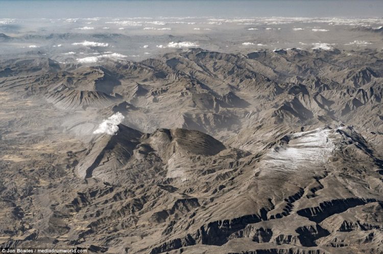
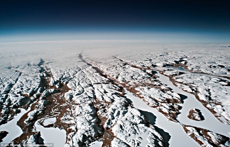
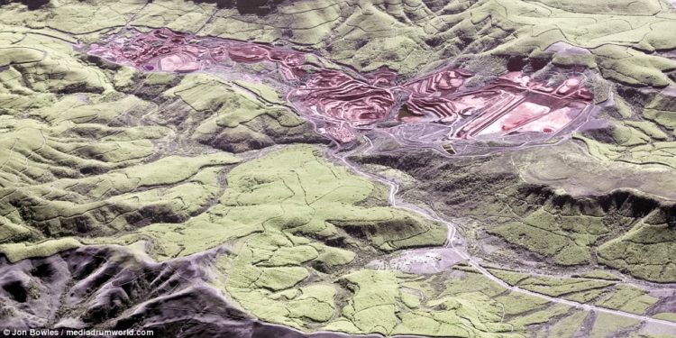
Aerial Photographs – These rolling fields and small towns in Bulgaria look they’re part of a puzzle in this snap taken from the cockpit by BowlesThe Red River, pictured in northern Vietnam, runs from the province of Yunnan in southwest China to the Gulf of TonkinThe British pilot’s amazing photography shows the world in a light impossible for the human eye to detect the Great Rift ValleyThe Bangladesh side of the Ganges Delta, which is the world’s largest delta. The Ganges is the most sacred river to HindusOne of the perks of the job for pilots is seeing some of the most amazing sights in the world, including Tanzania’s Mount KilimanjaroIran’s Lake Urmia, near the border with Turkey, was once the largest lake in the Middle East but has shrunk due to the damming of riversKnown for its wine, the city of Stellenbosch, near Cape Town in South Africa, was a European settlementKunyang Chhish mountain is located in the Karakoram range of Pakistan,Lake Van is the largest lake in Turkey. The saline soda lake is fed by water from small streams that run from the surrounding mountainsMany of Bowles’ best photos show rugged mountain ranges in Asia or Africa. This snap shows the Kunlun Mountains in ChinaBowles snapped this remarkable photograph of a hydrothermal vent while flying over the 3,700-mile Great Rift Valley in AfricaBowles used a modified Sony Nex 5N camera to capture these views in a completely different spectrum of rugged hills in IranBritish pilot Jon Bowles snapped this image of a winding river and land that was once under Lake Urmia, in northwestern IranCanada’s frozen Labrador coast, on the Atlantic Ocean. It is the mainland portion of the province of Newfoundland and LabradorDubai’s man-made Palm Jumeirah islands and its glittering skyline, which includes the Burj Khalifa, the tallest building in the worldBowles snapped this photo while flying over Dubai. It shows Dubai Marina, the desert city’s artificial canal districtBowles photographed K2, the world’s second-tallest mountain, Broad Peak, and the Gasherbrum, in the Himalayas and Karakoram rangesBowles’s infrared photo of the Padma River, in Bangladesh, looks more like a work of art than a photograph taken from as high as 40,000ftAn open-cast mine has a reddish glow in this photo, which was taken under infrared light from the cockpit of an airlinerWorld’s Aerial Photographs – An aerial view of an industrial zone shows different shades of color that are invisible to the naked eye