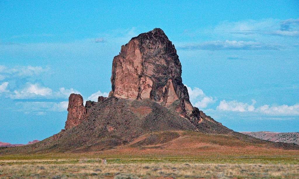
A 1,859-meter high summit of Navajo County in northeast Arizona, Chaistla Butte is located south of Monument Valley. A view of the site can be had from Highway 163, 7.2 kilometers northeast of Kayenta, on Navajo Nation land. A diatreme is a volcanic plug that has been eroded from the Navajo Volcanic Field. There are igneous intrusions and flows here that date back around 30 million years to the Oligocene and include Minette intrusions.
A 1,000 by 700-foot base rises from the Chinle Formation beneath Chaistla Butte, which rises 122 meters above Little Capitan Valley. Three miles to the north-northwest are Agathla Peak and Owl Rock. In this feature, precipitation drains into the Laguña Creek drainage basin. Its name, chaistla, means “beaver pocket” or “beaver corner” in the Navajo language and was formally adopted in 1915 as part of the U.S. Board on Geographic Names.

There is a belief that if this butte fell, the world would come to an end, according to Navajo teachings. Turkey Butte is another name for it. Chaistla Butte is best visited in the spring and fall. Temperatures are cold in winter and hot in summer according to the Köppen climate classification system.
The average summer high temperature is 32°C, and it rarely exceeds 38°C. As the sun sets, the temperature drops quickly, making summer nights comfortable. Winters are cold, but daytime highs usually exceed freezing during the day. Winter temperatures below 0 degrees Fahrenheit (18 degrees Celsius) are rare, but they do occur. Approximately 250 millimeters of rainfall per year in this desert climate. Winter is generally a mild season with little snowfall.