Liquefaction and Levees – Potential Double Disaster in the United States Midwest. Liquefaction is a process during which sudden shaking of certain types of water-saturated sands and mud turns these once-solid sediments into slurry having a liquid-like consistency. The term “liquefaction” is used to describe the process that causes the grains of soil to separate and then water flows through the soil, making the soil/water mixture behave like a fluid.
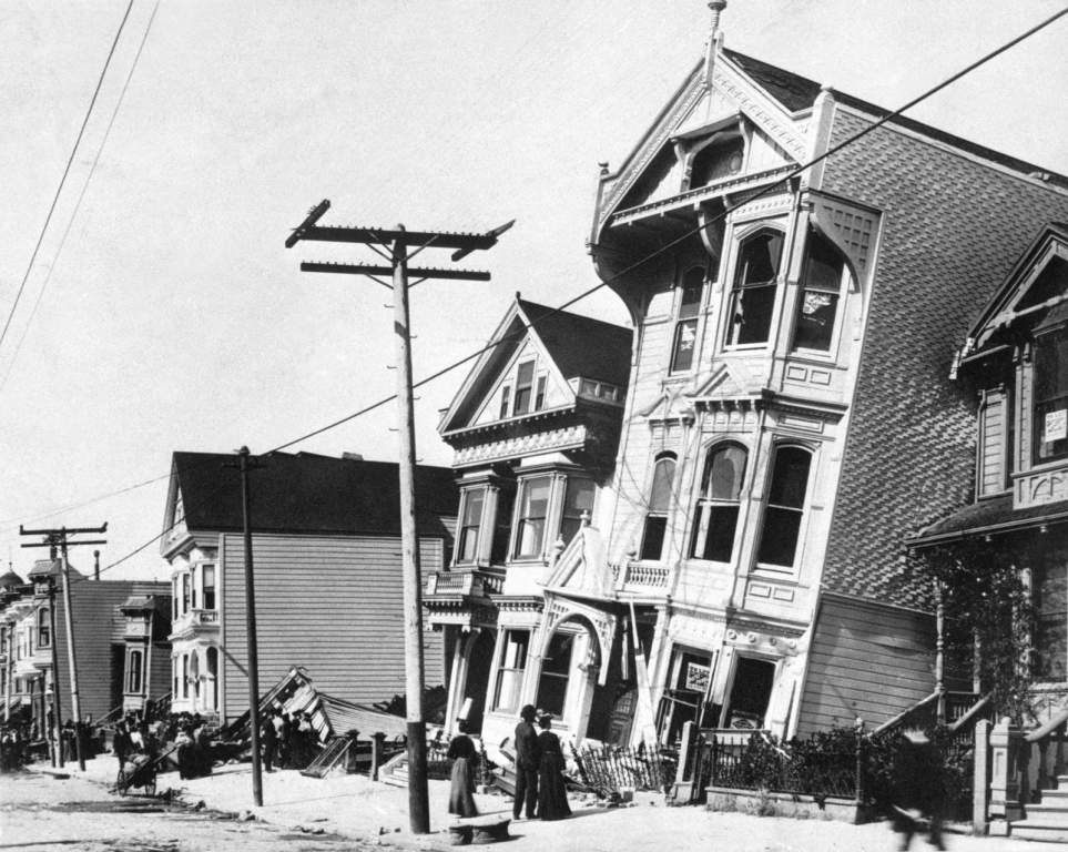
Earthquakes often cause liquefaction of sands and mud, and any structures built on soils or sediments that liquefy may suddenly sink into them as if they were resting on a thick fluid. Liquefaction causes the sand to bubble to the surface during earthquakes, forming mounds up to several tens of feet (10 meters) high, known as sand volcanoes, and ridges of sand to squeeze into cracks in the Earth. Liquefaction is responsible for the sinking of sidewalks, telephone poles, building foundations, and other structures during earthquakes.
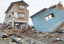
Famous examples of liquefaction occurred in the 1964 Alaskan earthquake when entire neighborhoods slid toward the sea on liquefied sand layers, and in the 1964 and 1995 Japan earthquakes, when entire rows of apartment buildings and shipping piers rolled onto their sides but were not severely damaged internally. Recent earthquakes and floods in the Midwest region of the United States passed with locally huge amounts of damage but were not catastrophic events for the entire region.
But one must consider what could have happened if the earthquakes were somewhat larger (which is possible) and occurred while the rivers were at high stages (which happens for more than a few months each year). One real threat is that many apparently stable levees may experience mass failure by liquefaction during an earthquake, potentially causing catastrophic flooding of regions behind this liquefaction and levees.
The United States Geological Survey reports that there is a significant risk to the soils in flooding plains in the Mississippi, Missouri, Ohio as well as Illinois Rivers in a report to the U.S. House of Representatives 2006. Eugene Schweig (of the U.S. Geological Survey) declared that if the earthquakes occurred during a time when they were occurring when the Ohio or Mississippi Rivers were high, the levees would be destroyed as well as flooding communities that are low lying. When the soils of the levees are soaked with water, as in flooding or high-water events the risk of it liquefying is higher.
Geological analysis of the banks of many rivers in the region has revealed that a magnitude six or seven earthquake struck about 65 kilometers east of St. Louis more than 6,500 years ago, and another occurrence struck about over four thousand years ago. Both events caused enormous liquefaction of the thick river sediments on the floodplains. Therefore, the massive earthquakes continued to hit the region in historic times by the 1811–12 sequence of magnitude seven or eight events, which also caused liquefaction of vast areas in southern Missouri and surrounding states.
On April 18, 2008, an earthquake in Illinois and aftershocks remind and warn us that the likely consequences of earthquakes on levees during high water must be considered. The two earthquake swarms in the Midwest in 2008, although minor, occurred when the local rivers were high. What would have happened if the earthquakes were slightly larger, say a magnitude six or seven? Would the levees have experienced mass failure and collapse by liquefaction? Levees fail for more than a few reasons.
They can be covered by floods, even scoured around their sides and bases, or let water enter the pores of sand and mud, causing a weakening of the structure until the pressure of the water rises and causes it to fall. The most devastating kind of failure could occur when the soils in the levee begin to melt due to the pressure of the high-pressure water as well as shaking caused by earthquakes or either. In these kinds of failures, hundreds of linear yards of levee can collapse in a flash in a flash, releasing torrents of water into “protected” areas behind the levees.
Studies by the United States Army Corps of Engineers suggest that a lot of the levees in the region are not strong enough to withstand shaking during an earthquake and may fail by liquefaction. The problem is particularly critical in communities such as those surrounding East St. Louis, Illinois, where the whole levee system is in the process of being decertified, as the levees do not meet modern standards for safety in earthquakes and from other stresses, such as floods.
If these levees fail during high water, the force of the Mississippi will surge into East St. Louis with the force of Niagara Falls, pushing into and covering the floodplain with a lot of feet (several meters) of water. Moreover, there are around 135,000 people living on the floodplain in the Metro East area near East St. Louis and rely on the levees for protection. If an earthquake causes massive liquefaction and failure of the levees, there will be little time to react, and many people will be stranded on rooftops, creating scenes reminiscent of New Orleans and Hurricane Katrina.
What can be done? The U.S. Army Corps of Engineers estimated that it will take $180 million to upgrade the Metro East levees to modern standards, and much of that money would need to come from local communities. If that is too expensive, residents on the floodplain behind the levees need to be aware of the possibility of mass failure of the liquefaction and levees system.
Flood-hazard and earthquake-hazard risk maps require to be compared to determine which areas have the greatest threat of liquefaction, and emergency management plans need to be established for the contingency of such a catastrophe. This could save lots of lives. Homeowners, businesses, local governments, and insurance issuers could do with to understand these risks and plan accordingly.
Related Reading – The Great Hayward Earthquake of 1868


