In northern Arizona, you can experience the incredible geological formations of Vermilion Cliffs if you make the effort to travel there and plan ahead. The Vermilion Cliffs are the second step of the Colorado Plateau’s Grand Staircase. In both Arizona and Utah, they extend for a considerable distance west of Page, Arizona. Paria Canyon-Vermilion Cliffs Wilderness covers approximately 45,500 acres of the region.
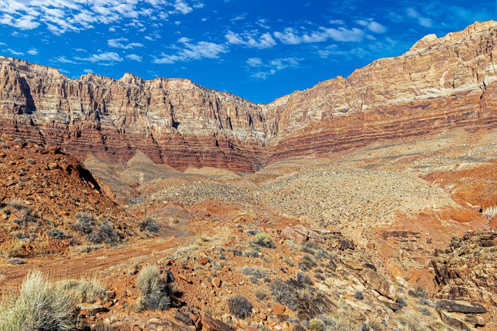
Vermilion Cliffs National Monument was expanded in 2000 to cover a larger area. Grasslands and cold desert habitats thrive in the arid climate of Vermilion Cliffs. The 3,000-foot cliffs, sinewy slot canyons, and massive formations jutting from the earth were created by millions of years of water and wind erosion on ancient layers of sandstone.
Vermilion Cliffs are composed of red sandstone beds from the Lower Jurassic Moenave and Kayenta Formations. These sand dunes are formed by deposited silt and desert dunes, which are cemented by infiltration of carbonate, and are richly colored by the presence of red iron oxide and other minerals, particularly bluish manganese. This region is part of the physiographic High Plateaus Section and Canyon Lands Section of the Colorado Plateau Province. In the 19th century, settlers used the Vermillion Cliffs as a route between Utah and Arizona.
During the Mormon pioneer and missionary Jacob Hamblin’s exploration of the area in House Rock Valley, he established a ranch there. In the present day, U.S. Highway 89A continues past the cliffs through House Rock Valley and up the Kaibab Plateau to Jacob Lake following the old wagon route. Coyote Buttes are multicolored bands created by leaching minerals at the northwestern end of the monument. Rock art and village remnants from the prehistoric Ancestral Pueblo (Anasazi) culture can be found in abundance at this monument.
There are several famous places in the cliff area, including Lee’s Ferry, Glen Canyon, the Glen Canyon National Recreation Area, The Wave, and Coyote Buttes. Reddish or vermilion-colored cliffs can be seen from Highway 89 near Bitter Springs, and along Highway 89A near Navajo Bridge. In between Jacob Lake and Marble Canyon, Highway 89A runs along the Vermilion Cliffs and offers great views of them.
Among the 20 species of raptors found there are reintroduced populations of endangered California condors. As well as desert bighorn sheep, desert tortoises, pronghorns, mountain lions, and a variety of reptiles, this area is home to a wide variety of wildlife. Grazing cattle, hunting, fishing, and hiking are all common activities on the land, much of which remains unspoiled.
During springtime, after a good winter rain, there will be a carpet of desert mallow and other spring flowers covering the valley between Highway 89 and the Vermilion Cliffs. Atop the Chocolate Cliffs in the above image, Highway 89A turns east (to the right) once it enters the valley below, eventually crossing the Colorado River at Marble Canyon via the Navajo Bridge.
Prior to Mormon pioneers settling in Lees Ferry in 1871, Spanish and Mexican explorers passed through the region. There are still ruins of Mormon homesteads. Additionally, while touring one of the most stunning geologic features on earth, be sure to look for petroglyphs on cliff walls and dinosaur tracks.