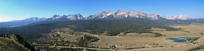
The Sawtooth Valley is scenic in the western United States, in Blaine and Custer counties in central Idaho, between the Sawtooth National Recreation Area (SNRA). On its west and the White Cloud Mountains on its east, with the Smoky and Boulder Mountains on the south. Approximately 50 kilometers long on the west side, the area is beautifully surrounded by the Mountains of Sawtooth. The White Cloud Mountains to the east, the Salmon River Mountains to the north, and Boulder and the Smoky Mountains to the south
It is the largest high-mountain valley in Idaho. The area has been inhabited by one or more wolf packs ever since 1998. The beautiful valley contains the headwaters of the Salmon River, the city of Stanley, and the community of Sawtooth City. It is an awesome place that begs you to pull over, lock the car, and put some ground under you’re feet or a trout stream around you’re knees.
At its picturesque heart stand the splintering crest of the Sawtooth Range, chaos of crags, razorback ridges, and small alpine lakes, and a tremendous view of its jagged northern edge rising over a wetland meadow. Stop at the Park Creek Overlook.
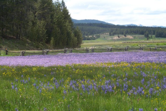
The SNRA offers many attractions, i.e., biking, camping, hiking, horseback riding, hunting, fishing, and remarkable wildflower viewing. The best time to see the wildflowers is in late spring, when the snow melts and the ground gets warm. There are three sensitive plant species that are endemic to the Stanley Basin: Stanley Whitlow Grass, Guardian Buckwheat, and Stanley Thalaspi. Further, the endemic species, the SNRA, is also home to an insectivorous species, the spoon-leaved sundew.
Therefore, in order to assure the preservation and protection of the natural, historic, scenic, pastoral, fish, and wildlife values and to provide for the enhancement of the recreational values associated therewith, the SNRA includes four mountain ranges: the Sawtooths, the Boulders, the White Clouds, and the Smokies.
This region has more than 1,000 high mountain lakes and is the headwaters of four of Idaho’s major rivers. Hence the Salmon, the South Fork of the Payette, the Boise, and the Big Wood. The complete length of the valley is traversed by State Highway 75, which is also recognized as the Sawtooth Scenic Byway. Highway 75 enters the valley from the south at Galena Summit and exits to the north near Stanley.
Moreover, Highway 75 was formerly United States 93, which is now routed through Arco. Sawtooth Valley encompasses several large lakes in the SNRA, including Redfish, Stanley Lakes, Alturas, and Pettit. The valley floor elevations range from just under 6,300 feet near Stanley to over 7,500 feet below Galena Summit.
The elevations of the Mountains of Sawtooth Valley are scenic in Blaine and Custer counties in the central Idaho Sawtooth National Recreation Area. It is also along the valley’s borders and reaches 11,815 feet at Castle Peak. In the White Cloud Mountains to the east and 10,715 feet at Thompson Peak in the Sawtooth Mountains to the west. Travelers will enjoy the scenic drive en route to the SNRA from any starting point. There are a variety of ways to reach the SNRA. Consulting a map source would be the best way to determine the easiest route.
10 Must-Do Hikes at the Sawtooth Mountains
-
Hike Fishhook Creek.
-
Backpack to Saddle Back Lakes.
-
Goat Lake Hike
-
Hike to Thompson Peak.
-
Redfish Lake to Alpine Lake
-
Hike to Sawtooth Lake.
-
Backpack to Imogene Lake
-
Hike to Bench Lakes.
Also Read: 4,000-Year-Old Termite Mounds Found in Brazil
.")