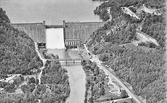
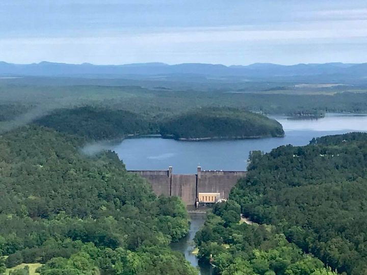
Situated six miles north of Murfreesboro in Pike County, Arkansas, Narrows Dam is a gravity dam that collects water from the Little Missouri River in Arkansas to create Lake Greeson. Dubbed “The Narrows” for the location in which it is situated, Narrows Dam created the lake. The Lake Greeson is used for hydroelectric power generation, leisure, and flood management. The primary developer of Lake Greeson was Martin White Greeson, who was born on November 7, 1866. There are about fifteen parks all around the lake where people can go camping, fishing, boating, biking, and swimming.
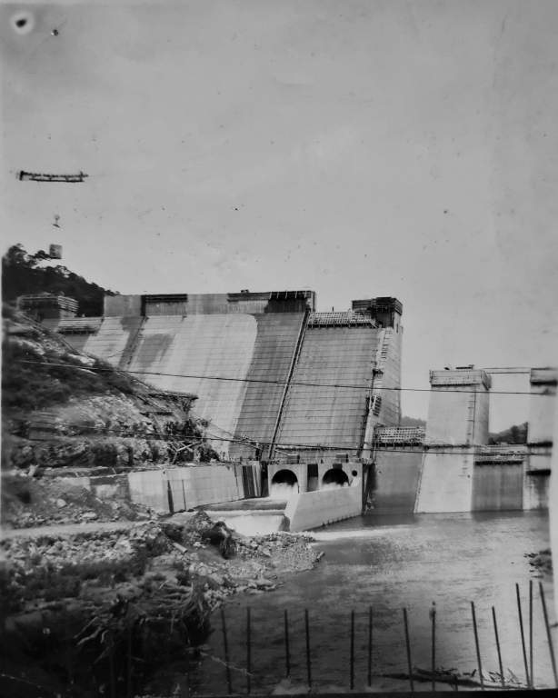
The US Army Corps of Engineers started construction on the Narrows dam in April 1947. The first pail of concrete was poured in June 1948. It took three years to complete the dam. The dam was completed in 1950 and hallowed in July 1951. A new lake was created by the dam, hence, there are numerous graves and burial grounds that had to be removed during construction. Narrows Dam is situated near the Swaha, or Narrows Dam recreation area. Any moment and by any means, a dam can suddenly and unexpectedly release a significant volume of water.
The Flood Control Act of 1941 allowed the Narrows Dam for both flood control and hydroelectric power projects. Narrows Dam was designed by CEMVK for the Ouachita River Basin and is now owned by the USACE-Vicksburg District. The Narrows Dam powerhouse sits next to the east abutment and is 940 feet (287 m) long, 183 feet (56 m) high. The powerhouse is equipped with three machines that generate 8,500 kW. The powerhouse initially had two generators, but a third was installed in 1969. The Narrows Dam average annual output is 28,000,000 KW·h. The reservoir’s typical storage capacity is 279,700 acre-feet (345,004 Ml), with a maximum capacity of 600,600 acre-feet (740,828 Ml). The reservoir’s surface area is 7,200 acres (2,914 ha), with a total catchment area of 237 square miles (614 square kilometers).
Lake Greeson is separated into three tiers so that Narrows Dam can function effectively. The bottom of the lake is always filled, so the powerhouse has adequate pressure to operate. The middle layer, the “power storage” part, regulates the flow of water into the dam’s generators. The top part, “Flood Storage,” is generally vacant unless floodwater is present.
The Narrows Dam spillway (maximum discharge capacity of 42300 cubic feet per second) regulates the flow of water. Since there are alternative methods of controlling floods, such as flood control tunnels, the spillway is rarely used on a regular basis. Heavy rains in the first two weeks of May 2009 caused water to go over the spillway for the first time since 1968.
Also Read: Cleft Island A Granite Island of Wilsons Promontory in Australia