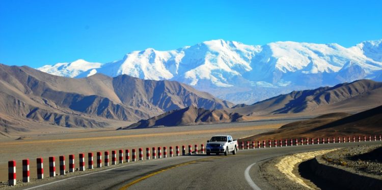
The KKH (Karakoram Highway) is one of the highest paved international roads in the world. The road is a popular tourist attraction across Pakistan and China. The KKH connects the Xinjiang Uyghur, China, and Gilgit-Baltistan of Pakistan across the Karakoram mountain range, located at an elevation of 15,397 feet (4,693 meters).
Due to its extreme elevation and the difficult conditions in which it was constructed, it is referred to as the Eighth Wonder of the World. It’s the road to heaven if you like exploring the mountains, that is. It’s considered one of the world’s hardest alpine climbs. In Pakistan, it is known as KKH, while in China it is known as China National Highway 314. Pakistan and China have had strong friendship relations for the last 65 years or so; hence, the KKH is also known as the Friendship Highway between the two neighboring countries.
In 1959, Pakistan and China made an agreement to construct KKH, and after so many scarifications of Pakistani / Chinese workers,. More than 1000 people lost their lives, making the mega-project open to the public in 1979. The Karakoram Highway is one of the greatest engineering accomplishments of the 20th century. Moreover, be ready for heavy snowfalls and landslides that can occur anytime and can sometimes block some sections of the road for several hours.
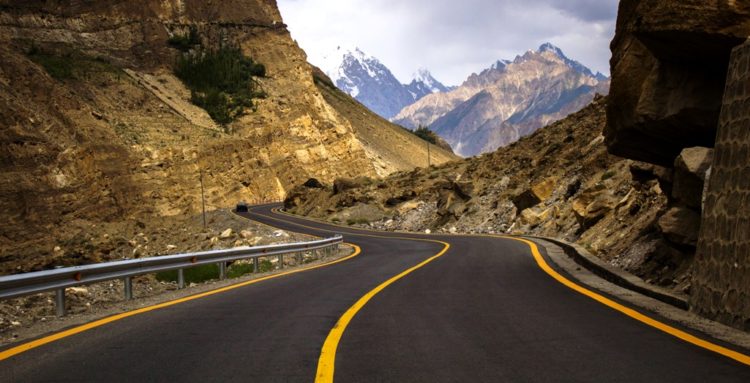
KKH is a real challenging road and a real test of your stamina and vehicle because the road abounds in twists and turns with wheels sometimes hanging above the precipice. The KKH is a highly land sliding area, tracing one of the many paths of the ancient Silk Road, connecting Gilgit-Baltistan of Kashmir with 1300 KM from Kashgar, China, to Abbottabad, Pakistan. Karakoram Highway has strategic and military importance to Pakistan and China. The KKH cuts through the collision zone, where China, Tajikistan, Afghanistan, and Pakistan come within 250 kilometers of each other.
Due to heavy-laden vehicles and extreme weather conditions, KKH has badly damaged, however, in 2006, Pakistan and China decided to rebuild and upgrade the KKH. The new proposed width is expanded to 33 to 98 feet, which will increase the transport three times to its current capacity with a new design to accommodate all vehicles and conditions. Moreover, another mega project is linking with KKH, by planning to connect KKH to the southern port of Gwadar in Balochistan.
This project is named economic corridor of the Pakistan / China trade route and reconstruction and upgrade works on the Pakistani portion of the Karakoram Highway are underway. China has bigger problems wanting to use Gwadar port as an economic corridor, which ironically lies more than 2,000 kilometers away, high in the cloud-tipped Karakoram mountain range in northern Pakistan.
In 2010, a massive 15-kilometer landslide cut off KKH in Hunza valley; created unstable Attabad Lake, when water flowed over the landslide dam. The Attabad Lake reached 22 KM in length and over 100 meters in-depth. The massive landslide destroyed many villages while killing many inhabitants. The subsequent lake completely displaced 20 kilometers of KKH, including 310 meters of long Bridge on KKH.
Therefore, goods transported over the lake by small vessels are reloaded onto trucks on the other side. So, in 2012, Pakistan started constructing a revised route around the lake at a higher elevation with 5 new tunnels The longest tunnel is 3360 m, followed by 2736 m, 435 m, 410 m, and 195 m, and 2 new bridges. The 24 km-long series of bridges and tunnels was completed on September 15. Therefore, the realignment restored the road link between Pakistan and China. The highest paved international road on the globe doesn’t come without its dangers.
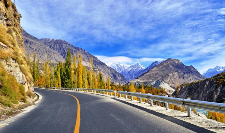
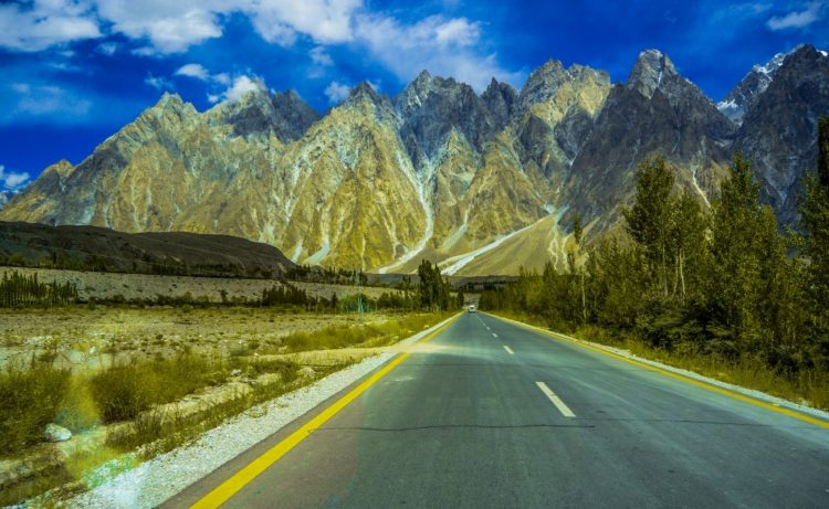
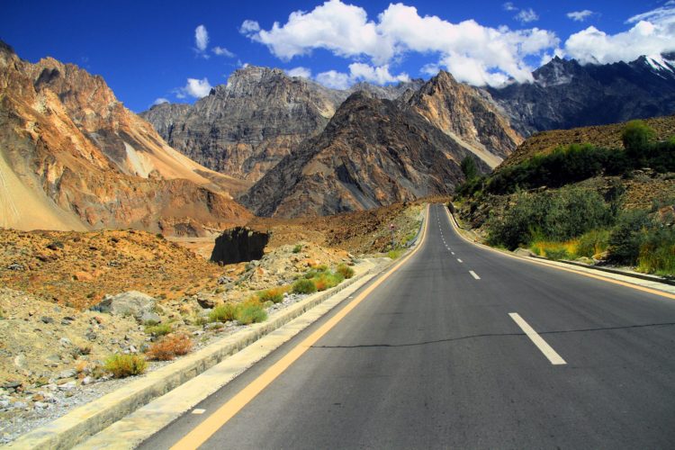
The KKH’s total length is 806 kilometers; it starts from Hassanabdal, of the Pakistan section, meets the Indus River, and continues along the river till Jaglot, where Gilgit River meets the Indus River. This is the place where great mountain ranges meet, The Himalayas, Hindukush, and Karakoram. The Nanga Parbat, the 9th highest peak in the world, can be seen from KKH. Moreover, The KKH passes through Gilgit Baltistan and continues through the valleys of Nagar and Hunza.
Thus, some of the highest mountains and famed glaciers in the Karakoram can be seen in this section. The highway meets the Pakistani-Chinese border at Khunjerab Pass. The KKH is exceptionally treacherous and requires a vehicle that can hold its own against some of the most challenging terrains in the world.
The KKH covers the major towns of Pakistan, Hassanabdal, Abbottabad, Besham, Chilas, Gilgit, Nagar, Aliabad, Gulmit, Passu, Sost, Tashkurgan Town, Ghizer, Upal, and Kashgar. The terrorist instability causes a niche adventure tourism destination. Since 2001, Pakistan has been a no go-to area for tourists, tending to only Pakistani and overseas citizens visit these areas.
Those who have visited these areas captivate the beauty of nature and KKH. In 2006, KKH was ranked the third-best tourist area in Pakistan by the Guardian. The unbelievable views of K2 along the way make it a popular tourist route; the 800-mile highway is a nightmare for people who are prone to altitude sickness. With absolutely no barrier on one side and a sheer rock wall on the other, the margin of driver error is fairly slim.
The KKH has given mountaineers and cyclists easier access to the many high mountains, glaciers, and lakes in the area. Karakoram Highway provides the pathway to expeditions for almost all peaks in Gilgit–Baltistan, Kashmir, and several peaks in Xinjiang, China. The region includes some of the world’s largest glaciers, like the Baltoro Glacier, Nanga Parbat, and K2. Five of the eight thousand mountains taller than 8,000 meters in the world that are in Pakistan are accessible by the highway.
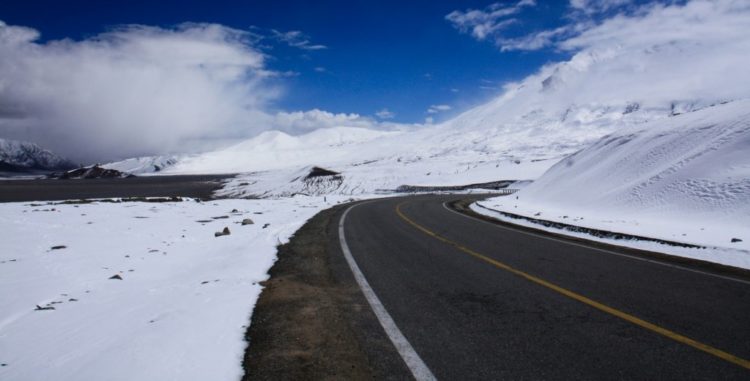
The KKH is best traveled in the spring or early autumn, when heavy snow during severe winters can shut the highway down for extended periods. Moreover, heavy monsoon rains around July and August cause infrequent landslides that can block the road for hours or more. The Karakoram Highway is one of the most popular roads to travel in Pakistan if you’re an adventure lover looking for a thrill.
Also Read: Stratovolcano of Mount Mayon