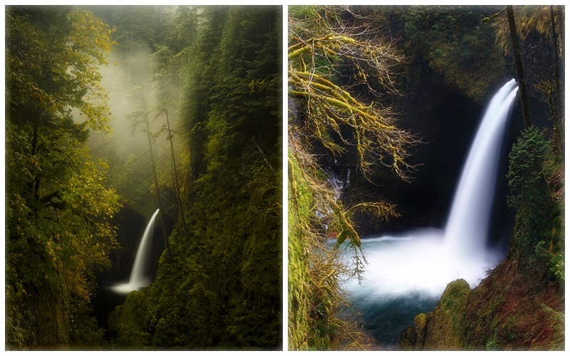
Metlako Falls is located in Hood River County, Oregon, the United States on Eagle Creek in the Columbia River Gorge National Scenic Area. Among the major waterfalls along Eagle Creek, this one is the furthest downstream. Metlako Falls are also shaped like punchbowls, just like Punch Bowl Falls upstream.
The Metlako Falls is 101 feet tall (31 meters), though people have measured it anywhere from 100 to 150 ft tall (30 to 46 meters). It is the upstream limit for salmon spawning in Eagle Creek. Since the gorge is steep, the falls were viewed from a relatively distant lookout a few miles downstream.
In 1915, a committee of the Mazamas discovered the waterfall and named it after Metlako. Since it is the upstream limit of salmon spawning in Eagle Creek, the Indian deity of salmon was most likely associated with it. The official viewpoint was destroyed by a landslide at the end of 2016, making viewing the waterfall impossible.

There were trees burned around the waterfall by the Eagle Creek Fire in 2017. Despite the difficulties (and dangers) of scrambling to the edge, Metlako Falls can now be viewed from a trail due to the lack of foliage. USDA Forest Service manages Metlaki Falls. Although Punch Bowl Falls could have easily been a stand-alone attraction, there are plenty of other waterfalls on the Eagle Creek Trail including Tunnel Falls, Eagle Creek Falls, etc.
The Metlako Falls was located at approximately mile point 1.5 of Eagle Creek Trail # 440 along the Metlako Falls Spur Trail. A typical route takes 1 hour and 48 minutes to complete, which is considered easy. During quieter times of the day, you can enjoy some solitude on this popular trail for birdwatching, hiking, and running. Along the river and at the falls are some steep and narrow parts, but there is also a beautiful view.
Winter storms caused the overlook to completely slide off the side of the cliff in December 2016. Upon visiting the site, geologists found that it was unstable and active, so anyone approaching the former overlook site could see the ground collapse at any moment. Eagle Creek Fire further damaged the area in 2017, when it burned the vegetation that was supporting the rocky slopes.
The cliff edge and replicating the trail must be avoided for your safety. Despite all this, Eagle Creek continues to have its own dynamic forces that create salmon habitat, wildflower habitat, and pollinator habitat.
Because of this, woody crevices provide habitat for creatures, and reemerging vegetation provides food for them. The cliffs had continued to be unstable, so signs had been posted all around the trail (probable to disguise where the trail used to be), and proceeding beyond the closure signs would be foolish given the possibility of more falls.
Related Reading: Wahkeena Falls Oregon


