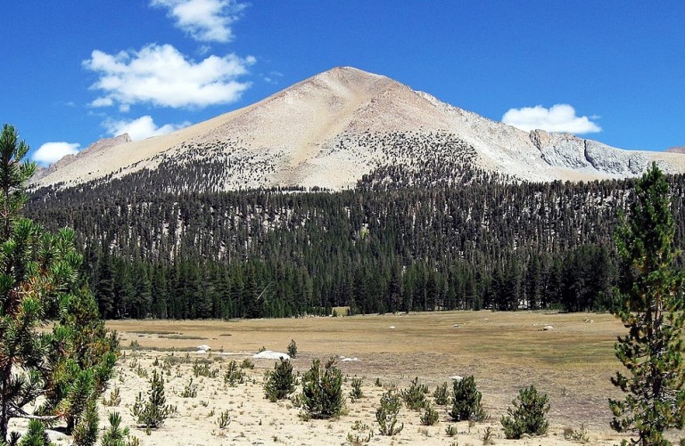
Mount Kaweah is a beautiful mountain located in Sequoia National Park, California. Its jagged profile makes it one of the most recognizable features of the High Sierra. Kaweah Peaks Ridge extends south from Triple Divide Peak and is part of the Great Western Divide. On the Kaweah Peaks Ridge, it reaches a height of 4,208 meters (13,807 feet).
Midway Mountain, at 13,666 feet, is another nearby distinction peak. Getting there should be a lot of fun. High mountain passes, glacial valleys, and granite peaks are some of the geologic features that are visible throughout the trek. Eventually, you reach a stunning area of wilderness that is remote and picturesque.

The magical peak offers spectacular views of some of the finest high country around, and it is complete wilderness with no city noise, no road noise, no pollution, and no power lines. In comparison with other “Emblems”, this one is not as frequently climbed. Thus, Frederick H. Wales, William B. Wallace, and James W. A. Wright climbed the peak for the first time in September 1881.
Located to the west of the Kaweah Peaks Ridge, the Kaweah River was the real inspiration to any hiker. There is no higher mountain in the southwestern Sierras than Mount Kaweah, which is higher even than the entire Great Western Divide west of the Kern Canyon.

However, the Kaweah drains into the Kern River. Therefore, the Kaweah River was named after the Kawai tribe, members of the Yokuts people. It was once known as Mariposa among the Yokuts. Mount Kaweah’s southern slopes are home to a rare pine species, the Foxtail Pine. These pine trees add natural beauty to the surrounding area.
The highest mountain in the southwest Sierra is Mount Kaweah. Above Big Arroyo, the peak is a three-mile hike off the High Sierra Trail. Moreover, the glacier pass is the easiest way in, followed by Blackrock Pass and Little Five Lakes. It is best to climb when there is little or no snow. As a result of avalanche damage, the trails are very steep.

Other Facts
County Second Level Region: Tulare County, California, U.S.
Parent range: Great Western Divide, Sierra Nevada
Topo map: USGS Triple Divide Peak
First ascent: September 1881
Easiest route: Hike, class 1
Elevation: 13,807 feet (4,208 meters)
Prominence: 2,027 feet (618 meters)
Latitude/Longitude: 36°31′34″N 118°28′42″ W Coordinates: 36°31′34″N 118°28′42″W
Listing: North America’s highest peaks 76th US highest major peak 58th California’s highest major peaks 9t SPS Emblem peak and Western States Climbers Star peak


