Belizeans consider the mountains of Pine Ridge Forest Reserve to be a national treasure. So, therefore, the devastating spread of the south-central pine bark beetle, which first began to affect the forest in 2000, has caused distress across the nation. While they feed, larvae of the beetle kill trees, and a new set of larvae is born every four to five weeks.
When you travel the sandy roads in the reserve, you’ll find areas of barren dead pines reaching the horizon. More than 75 percent of the area’s trees are gone. Fortunately, the issue is now under control through a broad-ranging forest reforestation plan, and the trees are now expected to grow back.
Even dead trees contribute an important contribution to the ecosystem, give woodpeckers hunting habitats as well as other insects, and also decrease the size of the forest as they fall. This makes an outbreak less likely.
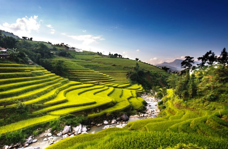
A vast and rugged area of rolling hills, valleys, and peaks that begins approximately 10 miles to the south of the George Price Highway. The Mountain Pine Ridge Forest Reserve is home to one of the most stunning landscapes in Belize. Its peaks are formed from the oldest rocks of Central America, granite intrusions that have pushed upwards from the bedrock underneath the entire isthmus.
In between, there are sections of limestone dotted with magnificent caves. The Pine Ridge is generally a mix of pine forest and grassland that grows in nutrient-poor sandy soil. The vegetation becomes larger in the valleys of the river than in the south. On the Macal River, the pines give way to the forest. With the exception of a few tourist lodges and the tiny Forest Reserve headquarters in Augustine/Douglas Silva, Pine Ridge is virtually uninhabited.
The majority of people who visit this area will be heading towards the historic city of Caracol. However, it’s worth taking a slight detour from the main road to visit sights like the impressive Thousand-foot Falls located on the northern ridge of the ridge, stunning swimming pools in the Rio On-stream, and the easily accessible Rio Frio cave.
The only route that leads into the reserve itself that is accessible to the reserve itself is Chiquibul Road, which leaves from the main road at Georgeville and is joined with the Cristo Rey Road. That is a straight route that is located from San Ignacio, just over one mile to the gates.
All visitors must register (there’s no admission charge or hours of operation, although the recommended hours of the visit are between 8:30 am and 4:00 pm). All roads are not paved and therefore are likely to be muddy and dangerous in the wet season; it’s best to travel with the 4WD option and ask locally about current road conditions before setting out.
Big Rock Falls
Lies 1.5 miles west past Blancaneaux, off Chiquibul Rd. Only the fit and physically strong can make the strenuous and difficult (though shorter) journey up to Big Rock Falls, a relatively wide cascade along the Privassion River. The way up to the parking area provides views of the falls and the creek, as well as massive granite boulders and the forest is decorated with tiny orchids and lush greenery.
After you’ve climbed down through wooden steps, with ropes to hang from, the 150-ft waterfall is best enjoyed lying on the bed of rock with an afternoon picnic. Because the water beneath the falls is very deep, it’s nearly necessary to climb up to have a dip or two. Be careful not to take it easy, as the return trip back towards the parking lot can be more demanding than the walk down.
Rio On Pools
Ten miles to the south of the entry point of The Pine Ridge reserve, the Chiquibul Road traverses The Rio On, one of the numerous streams that drain westwards toward Macal River. A spur road that runs to the west will lead into Rio On Pools.
Rio On Pools, where the river pools among massive granite boulders before descending into a gorge just close to the road. It’s a stunning spot to bathe; it’s an ideal stop for a relaxing afternoon to return to Caracol in the summer after the pools have the chance to get warm and you’ll be grateful for the chance to cool off. Augustine/Douglas S. Silva is a small town of
Augustine/Douglas Silva
Augustine is located 26 miles from the south of the highway and five miles further than Rio. It is located in Pools and is the headquarters of the reserve. The reserve was initially named Augustine and later changed to Douglas Silva to honor the local politician.
There were not many signs of change, however, and there was no complete change. The majority of houses in Caracol have been abandoned for years, however, there are usually forestry employees who are around and should be able to provide advice regarding roads and road safety if you’re headed towards Caracol.
Rio Frio Cave
One mile to the west of Augustine or Douglas Silva, a sign that is posted on the track will lead west from Douglas Silva/Augustine to Rio Frio Cave. Rio Frio Cave; most Caracol tour operators travel to the cave, however, when you’re driving your own vehicle, the terrain isn’t easy enough that it’s worth taking a walk for an hour instead.
Then, you’ll be confronted with the biggest opening to a cave in Belize, a massive 100-foot opening in which you’ll find the Rio Frio emerges from beneath an unassuming hill. It’s actually more of a tunnel than a cave. If you go into the mouth with its foliage and carry the torch, you’ll be able to climb across limestone terraces for over a half mile before you’re back into the wide. Sand shores and rocks run along the river’s two sides.


