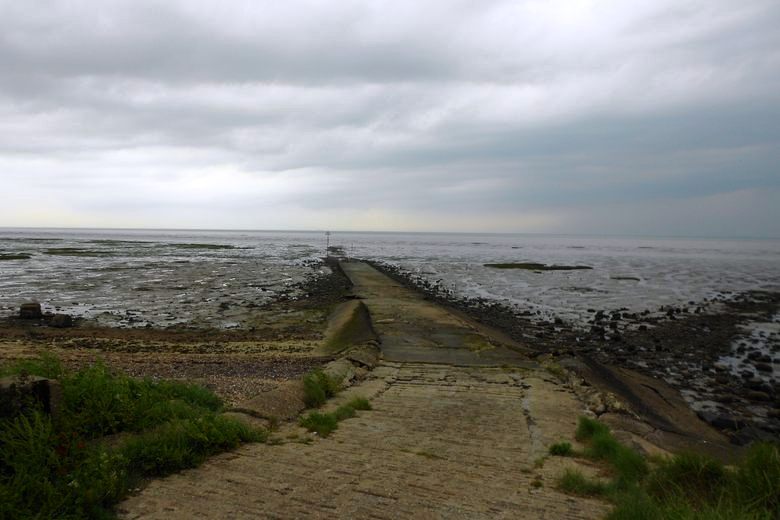
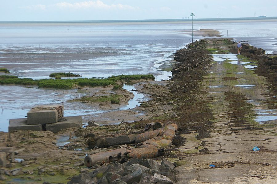
A public right of way over the foreshore, the Broomway was formerly known as the “Broom Road” One of the most unearthly paths you will ever walk. On the estuary of River Roach, Foulness Island, Broomway is located on the east coast of Essex, England. There are six miles of the Broomway along the Maplin Sands, about 440 yards from the present shoreline.
The Broomway is more than 600 years old. In the past, the route was marked with short poles attached to bundles of twigs called “brooms”. There is a danger of disorientation, as well as inundation: the self-similar terrain, with sand extending in all directions, is easy to get lost in mist, rain, or fog.

There have been military control over this place for a long time. It was the War Office that first established the artillery range there in the mid-19th century. Currently, it is used to test new weapons and ammunition by the Ministry of Defence. The island is perfectly situated for this purpose since it is far from large population centers. Water from the River Crouch and River Roach creates whirlpools on the track during misty weather, as the massive incoming tide floods the sands at high speeds.
However, civilians are present on the island itself as well. A few families grow wheat, barley, peas, and linseed on leased land alongside killer grenades, explosive shells, and guided missile systems. Foulness Island is unique because of this bizarre arrangement.

In the past, Foulness Island could only be reached by ferry or by walking along the tidal flats of Maplin Sands when the sea receded. The Broomway is a sea route that is supposedly the most dangerous in Britain. Wakering Stairs is the starting point for the Broomway, which extends straight out to sea.
On the uppermost tip of Foulness Island, following about 400 meters of the coast, the route turns northeast for about 5 miles before turning back towards land when it reaches Fisherman’s Head. Since the bridge was opened to the island and the “brooms” were removed, the Broomway has largely disappeared. A compass bearing over Maplin Sands serves as the Broomway’s route for the majority of its six-mile distance.
A good day on the beach makes the route appear nothing more than just a long walk. Nevertheless, the tide comes in faster than one can run. It doesn’t take long for the water to reach your hips and then your chest. The Broomway has claimed the lives of countless people.

It is thought that the Broomway dates back as far as 600 years ago, however, Roman settlements have been discovered on Foulness Island which strongly suggests that this ancient route predates the Romans. A coastal erosion-induced flood caused the track to be flooded during Anglo-Saxon times. Wooden hurdle work was once used to reinforce the southern section of the Broomway, according to archeological surveys.
Maps of the Broomway were well-marked by the end of the 16th century. Landings were marked by short-handled brooms with the bristles pointing upwards stuck into the mud. It is from this source that the name originates. Herbert W. Tompkins wrote in the early 1900s that the black dots formed by the brooms would indicate when travelers might start their journey as the tide ebbed.
Keeping the brooms in good condition required regular maintenance, and the island’s major landowners and parish have funded the path since at least the 18th century. By then, farmers were using the Broomway to bring their products to market from the island. The Broomway is technically considered a bridleway between Rugwood Head and Fisherman’s Head.
Broomway presents a variety of hazards, but incoming tides are the most dangerous. It’s difficult to see the coast, and if it’s foggy or raining, it can be easy to get disoriented, wandering into soft mud and quicksand. The tide may kill you if you cannot reach land before it comes in. It is estimated that over 100 people have drowned in Foulness Sands since 1600, according to the Foulness Burial Register.
On Foulness Island, there is also a firing range. Artillery shots are regularly fired into Maplin Sands and the Thames estuary, where they explode and leave large craters. The tide fills these craters with soft mud, causing pits of sinking sand that is invisible to the naked eye. Unexploded shells also pose a risk.
Today, Foulness Island can be reached without the Broomway, or the “Doomway,” as locals call it. Several bridges were built by the military to connect the island to Wakering Stairs in 1922. The Broomway is still used by some people to reach Foulness island for the sake of adventure.
Related Reading – Passage du Gois – A Submersible Causeway


