The Sahara desert plateau in North Africa is the largest arid region in the world. It has an estimated area of 3,500,000 sq. Mi. Its most extensive length is 3,200 miles. Its breadth, from north to south, varies from 850 to 1,400 mi. The Sahara desert stretches from the Atlantic coast to the shores of the Red Sea. However, the whole is not entirely a desert region but contains many districts with numerous fertile oases and some vegetation.
The desert, which separates North and Central Africa, has historic links with the Mediterranean Sea. Since the present political control operates mainly southward from French Northwest Africa and Libya, it may be conveniently included with the lands to the north. The Sahara is bounded on the south by French and Anglo-Egyptian Sudan. On the east, the region continues into the Nile lands and includes the Libyan and Nubian deserts.

Surface Features: The Sahara is far from uniform in character. In the center, there are well-defined mountainous regions presenting, like the sand, very formidable barriers. The entire area is crossed by dried-up river valleys known as muddies, whether they contain water or not. The desert, moreover, is not uniformly sandy, for on the summits of the plateaus the ground is generally rocky and covered with large stones.
These regions are referred to as Hamadas or Gautras, and when crossed by ravines, they are called Chebkas. In the sandy areas large dunes, or Ergs, are formed by strong winds. The region known as Tanezruft, an absolutely sterile section without water or inhabitants, lies between the Ahraggar massif and the elevated country of Adrar.
Wherever no vegetation occurs in these parts, the rocks forming the desert surface weather much faster than where they are protected by plants. Through alternate heating in the daytime and cooling at night, small fragments are splintered off which gradually become fine sand. The sand is shaped into huge dunes by the wind so that in a journey over these areas it is impossible to see for long distances.
The majority part of the Saharan region lies below 1,500 ft. altitude, although the central belt exceeds this elevation. The line of depressions separating the Atlas region from the main Saharan plateau includes the Adrar area in Mauritania (El Juf), the Tuat depression, and the region marked by the Shott el Jerid and the Shott Melghir, the latter being about 100 ft. below sea level. The Bodele Depression occupies a large area in the Military Territories northeast of Lake Chad. In the central Sahara, the Ahaggar massif is connected with the Air massif on the south and flanked on the northeast by the Tasili plateau.
From here an elevated belt runs southeastward through the Marra Mountains and the Tibesti highlands to Dar Fur in the Sudan. This high heart of the Sahara exceeds 6,000 ft. in only a few places. In general, it represents the crystalline foundation of Africa, a relic of the ancient plateau of a higher level. Primary rocks flank the higher parts, and there is a lot of intrusive granite as well as volcanic rocks, particularly well represented in the Air Massif.

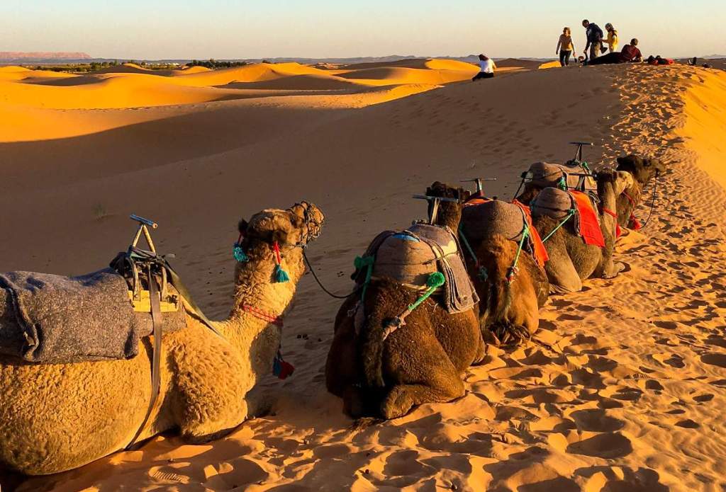
Inhabitants: There is considerable diversity and a mixture of peoples in the Sahara. Broadly speaking, late. Separates Arabs and Berbers from Negroid types. Mauritania has Arabs and Berbers in the north and blacks in the south. Ahaggar and Air are inhabited by the Tuareg, “the people of the veil,” a fascinating Berber type. The men go veiled, scorn manual work despite their strength, and constitute a tribe of camel men. They long dominated the chief Saharan caravan routes and have only recently been subdued by the French.
They are not numerous, and it seems probable that they will die out. The only activity that appeals to them is marauding, and they mix more and more with the Negro types that the slave trade brought to the oases. To the east, in the Bodele and Tibesti regions, the inhabitants are chiefly Tibbu types, Hamitic Negroes, the only Negro people to survive in the Sahara, and a sprinkling of Arabs.
In the north and west chiefly Arabs of two kinds are found: settled Arabs, living in flat-roofed mud houses in the oases; and nomadic tribes, living in tents and wandering in the semi-desert from well to well. The need for pasture and water has largely contributed to the unruliness of the Saharan peoples. Their resistance to European penetration has been increased by fanatical Mohammedanism. The last slave trade stronghold was the Wadai region, east of Lake Chad.
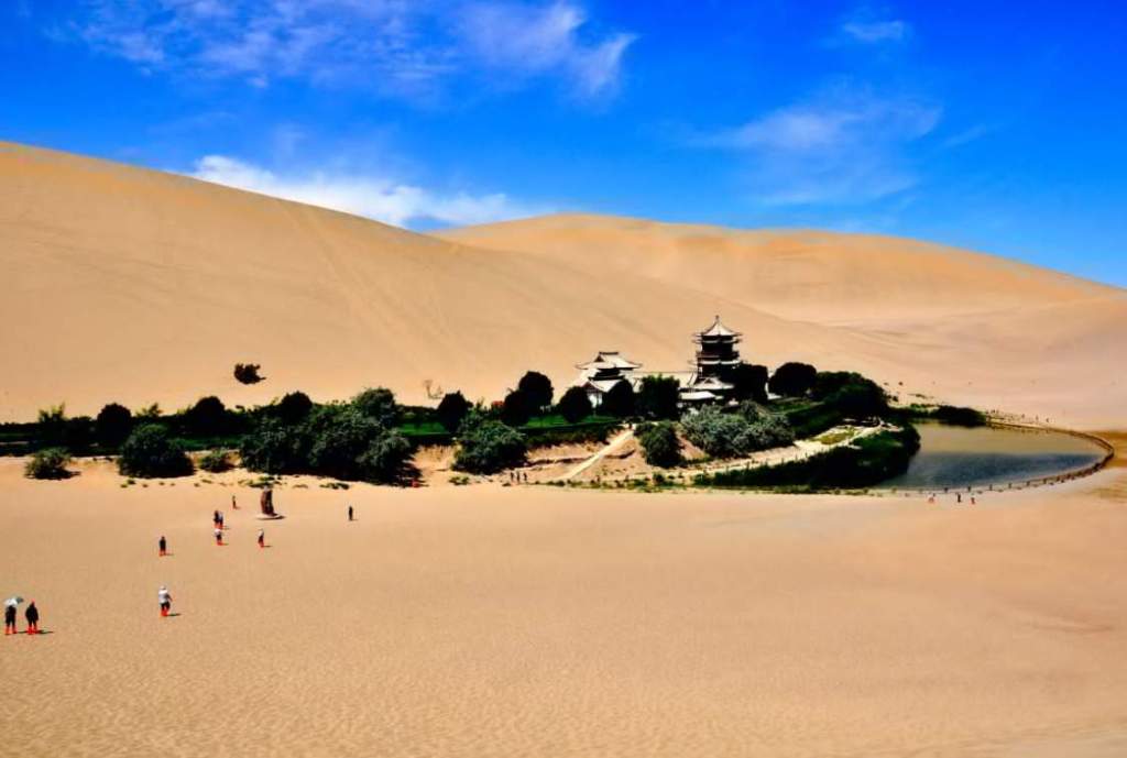
Oases: The principal oases of the northern Sahara are Wargla, Biskra and Tuggurt, in southern Algeria, irrigated from deep wells; Tuat, Guara, and Tidikelt, areas containing numerous watering places, lying to the southwest of Algeria; Tafilet, a large oasis in the south of Morocco, containing many villages; Adrar, an elevated district with several fertile spots, to the east of Rio de Oro; and Ghadames, Ghat and Murzuk in Libya.
In the Libyan Desert, the chief oases are Siwa, Jarabub, and Kufrah, the two last being cities of the Senussi, a fanatical Mohammedan sect whose headquarters are at Kufrah in the center of the desert. Large quantities of dates are grown in the oases; the Degla variety is specially cultivated for export. A variety of fruits, barley, and millet are grown.

Rivers and drainage: The Sahara desert has only a “fossil” river system, a series of wadis, with a focus on the Ahaggar-Tasili highlands. These represent an immature river system developed during Europe’s glacial era. In the Adas region, there are short rivers, with a considerable winter flow which provides the only drainage to the sea in this large division. The Ahaggar massif may be regarded as a significant water parting in that it marks the divide between considerable drainage systems developed during the glacial epoch.
Wadis now occupy deep valleys, which have been protected from erosion by desiccation. It is believed that the Wadi Igharghar, formerly drained to the low shotts of southern Algeria, and that the Wadi Tafassaset, which drained the eastern part of the Ahaggar massif to the Niger, received the Agades river from the air. It seems probable that the Carthaginian elephants, obtained from the lowland shotts region, crossed the Sahara through the Ahaggar massif. A degenerate crocodile can be found in the northern valleys of the Ahaggar.
There is evidence that desiccation has continued until now. Another prominent drainage feature is found in the numerous wadis that drain southward from the Atlas Mountains, and which come down in floods during the winter. Beni Abbes’ Wadi Saura floods regularly. Occasionally the wadis themselves provide water for the oasis, but equally significant is the vast quantity of water underground in this part of the Northern Sahara. Wadis from the Tibesti highlands drain to the Bodele depression, which appears to have been filled with water from Lake Chad.
Flora and fauna: Date palms are found in the oasis. Acacia trees are plentiful in the Hamadas. Desert plant life is confined primarily to acacias, tamarisks, and coarse grasses. Jackal, fox, gazelle, badger, and hare are found in the desert. The lion is now almost extinct. Reptiles include horned vipers, lizards, scorpions, and crocodiles.
Climate: In Sahara desert there is an extensive range of temperatures throughout the day. In northern areas during the winter the thermometer frequently sinks below freezing point at night and rises in the daytime to over 100° F. On the high plateaus of the central Sahara, the almost complete absence of all flora and fauna is largely due to the great differences in heat and cold and to the incessant winds. In the Ahaggar highlands, temperature variations are extreme. Generally, the Sahara climate, unfriendly to flora and fauna, is favorable for man.
Intense heat causes wind storms known as simoons, which fill the air with sand and drive fine particles into the skin pores. During the late summer, some rain falls on the southern margin of the desert. This is due to brief monsoonal incursions of southwesterly winds from the Gulf of Guinea. These winds penetrate beneath the prevailing easterly or northeasterly winds, probably to a height of about a quarter of a mile. The rainfall appears to be of a conventional type.
The convection apparently mixes the opposing currents and often leaves the easterly wind temporarily occupying even the lowest layers. Occasionally this process gives rise to tornadoes of the African type. These tornadoes are line squalls and not destructive vortices like United States tornadoes. The rainy season is complicated and interrupted by various breaks.
As in many other parts of Africa, the more mountainous districts are likely to get abundant rain, while the relatively low-lying plains not only have a very small annual fall, less than five inches but also one that is capricious; in large areas, scanty desert vegetation is maintained only precariously. Snow rests temporarily in winter in the higher parts of the Ahaggar, where temperatures are likely to rise to 120 F. in comparison with the surrounding Sahara desert. High-quality pasture land for goats, sheep, donkeys, and camels is found in these highlands.
Read More – Guelta d’Archei – A Hidden Treasure of Sahara Desert


