Breakneck Ridge New York is located between the towns of Beacon and Cold Spring, along the Hudson River. A strikingly scenic gateway to the Hudson Highlands, Wey-Gat, or Wind Gate, is characterized by its rocky cliffs, visible from a long way away when approached from the south. Breakneck Ridge is called that because it is a ridge. In a book published in 1849, Breakneck ridge was named after the mischievous bull that broke his neck after a local farmer chased him off a cliff.
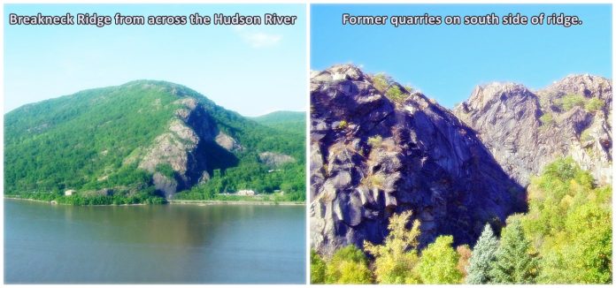
This mountain range has several peaks, the highest of which is approximately 1,260 feet above sea level, some distance inland. A notable feature of the southern face of the peak is the impressive cliffs formed over time as a result of past quarrying.
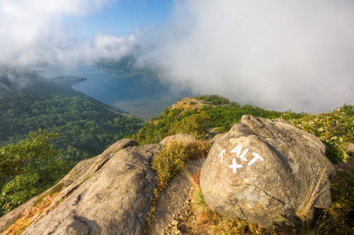
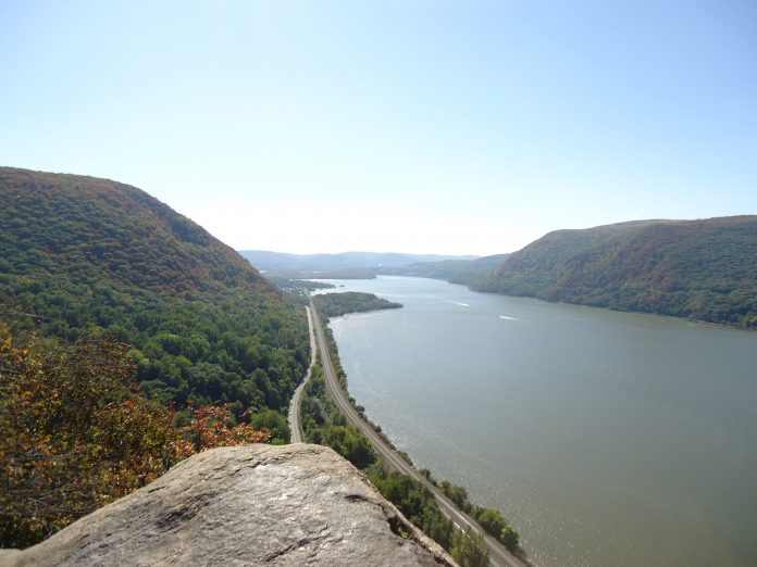
With many breathtaking views of the river and surrounding region, Hudson Highlands State Park offers many great views. There has been much interest in the trail, to the point that a rail flag stop has been established on the Metro-North line that runs right along the base of the ridge along with NY 9D. Under the western slopes of the peak was dug a tunnel in 1932, that is now part of Route 9D.

St. Anthony’s Face and Turk’s Face were also names applied to the mountain in the early 20th century. An 1846, a quarryman destroyed a face-like rock formation on the southern cliffs. Ascending rocky faces and ridges is known as rock scrambling. Rock scrambling is not the same as rock climbing, nor is it the same as walking. In general, rock scrambling is associated with trails that can lead to summits that are not technically challenging.
Depending on the route, the trail distance is between 2.5 and 4 miles. Approximately 1,250 feet of elevation gain and a strenuous but doable difficulty level make up this hike. There are a number of trails up the mountain, but the most popular is the white-blazed route that starts from the west (southbound) side of Route 9D near the tunnel.
During the months of April through November, this trail is most enjoyable. Leashed dogs are allowed on this trail. There are sweeping views of the river and Highlands from the first bump of the mountain, which is about 720 feet above the river after passing over the tunnels.
Over the remaining bumps, the path continues in the same way until it reaches the summit. It eventually evolves into a trail that traverses several other summits and eventually ends. The white trail is not the only path leading down from the summits the white trail crosses. There are also blue, red, and green trails ascending from other summits that the white-blazed trail crosses. The paths serve as shortcuts.
The Ninham Trail was opened in July 2021 as a safer alternative to ascending Breakneck Ridge and descending the mountain for less experienced hikers. It is named after the former Wappinger chief, Daniel Ninham. Breakneck Ridge has been used as the source of more than 500 steps on the brand-new trail. Breakneck Ridge ascent (white trail) has been converted into a one-way, up-only trail after the opening of the Ninham Trail.
When climbing Breakneck Ridge in New York, how long does it take? – Those with a limited amount of time can choose the short loop, which is only 1 mile longer but requires only 2 hours. Those with an insufficient amount of time can opt for the classic loop, which takes 3 hours. If you wish to extend your trip even further, you can take one of the many trails that branch off of the Breakneck Ridge trail.