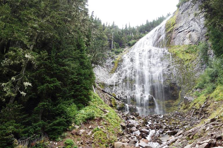
The Spray Falls is located in Mount Rainier National Park in Pierce County, Washington. Spray Creek is a tributary to the Puyallup River, which supplied the water to Spray Falls. A veiled horsetail form drops 354 feet into a talus slope about 100 feet wide. Spray Falls earned a spot on the Top 10 Best Washington Waterfalls List due to its sheer size and unusual shape.

An average snowpack year would probably see its flow diminish as summer progressed. It is thought that Spray Falls was discovered in 1883 when the Bailey Willis Trail was constructed. It has since been replaced with the Spray Park trail. Originally named after the physical nature of the falls, it was later extended to the creek and Spray Park as well.
You could experience a thrilling and adrenaline-pumping experience at Spray Falls. If you settle for partial views, you may be disappointed, or you may forget about the experience entirely. It would be best to try to get a good view of the falls in case something bad happened. The one you shouldn’t miss if you love waterfalls and you’re in Mount Rainier National Park already. Spray Falls is particularly impressive during snowmelt, as the trail that leads there is idyllic.

In the beginning, the falls are a narrow horsetail drop, about 10 feet wide, but then the stream quickly widens to about 75 feet as it skips down a diagonally pitched outcrop. As the cliff descends about 130 feet, it twists slightly to the river left and turns almost sheer, causing the remainder of the fall to twist off its initial angle of descent, broadening to over 100 feet in width, and falling freely to the talus slope beneath.
When viewing the waterfall from the end of the trail, there is considerable foreshortening in play due to how the creek twists as it falls and how the trail approaches the fall. A large portion of the waterfall cannot be viewed because of trees further downstream. Nevertheless, there are a few places along Spray Creek near its confluence with Grant Creek. The falls are much more clearly seen and appreciated when viewed that way.
Spray Creek derives its water from remnants of the Flett Glacier, but because the glacier is extinct now (though not as much as other small glaciers on Mount Rainier), it is also dependent on the winter snowpack.


